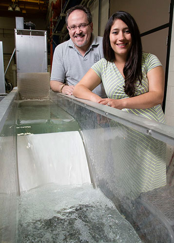
University of Illinois researchers Tatiana Garcia, a graduate student and civil and environmental engineering professor Marcelo Garcia developed a tributary assessment tool to predict how Asian carp eggs will disperse after spawning that will help resource managers develop strategies for preventing the spread of the invasive species if they were to move into the Great Lakes. Photo by L. Brian Stauffer, University of Illinois News Bureau.
New tool helps in understanding how Asian carp eggs spread
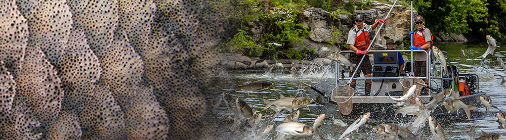
To combat the threat of invasive Asian carp in the Great Lakes, the University of Illinois, in collaboration with the U.S. Geological Survey, has developed a tributary assessment tool to help predict which Great Lakes tributaries might be vulnerable to Asian carp spawning and could support egg transport and development. The tool, Fluvial Drift Simulator (FluEgg), is a three-dimensional numerical model developed to evaluate how rivers carry and spread Asian carp eggs. The model incorporates information about Asian carp egg development and river flows to provide insights regarding the likelihood of a river to be suitable for spawning, the potential of a river to transport Asian carp eggs in suspension until hatching, and the identification of the location of Asian carp eggs at different developmental stages. This information is important because it is believed Asian carp eggs must stay off the river bottom in order to hatch.
“FluEgg follows every virtual egg based on the velocity and turbulence of the river you are simulating,” said Tatiana Garcia, a University of Illinois doctoral student and first author of the paper describing the model. “The location of the eggs is tracked in time and three-dimensional space. The model helps answer the question of, if carp have spawned at a certain location, how will the eggs be dispersed downstream? Will they sink? Will they hatch before reaching the Great Lakes? The answers to these questions are critical components in research to determine if the Asian carp can establish a sustainable population in the Great Lakes.”
See a video of FluEgg in action.
FluEgg simulation results can be used to develop prevention, management, and control strategies targeted to specific developmental stages. Scientists, managers and policy makers will benefit from this tool because it will enable them to make informed decisions for controlling Asian carp.
This is a GLRI/USGS funded project in the Asian Carp Control Strategy Framework (Action Item 2.5.11).
View the University of Illinois News Bureau release
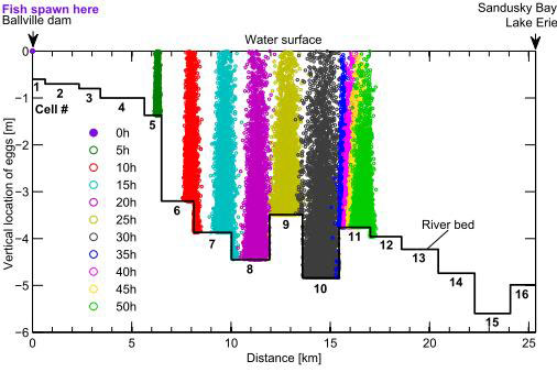
Evolution of the movement of a mass of 5,000 simulated silver carp eggs in the lower Sandusky River in Ohio. The y-axis indicates the vertical location of the eggs, and the x-axis indicates the distance downstream from the Ballville Dam (simulated spawning location). The y-axis equal to zero corresponds to the water surface. The solid black line indicates the cells representing the river bed with each cell corresponding to different physical conditions measured in the river reach.